

Rapa Nui (Easter Island)
About 3 million years ago, a volcanic eruption created a tiny island in the middle of the Pacific ocean. Then about 2 millions years ago, another volcanic eruption created a second tiny island next to it. And finally, a third eruption about 10,000 years ago connected the two islands to be one “big” island. By big, I still mean tiny. Rapa Nui is 163 square kilometers. If it were a perfect square, that would mean about 13 kilometers per side.
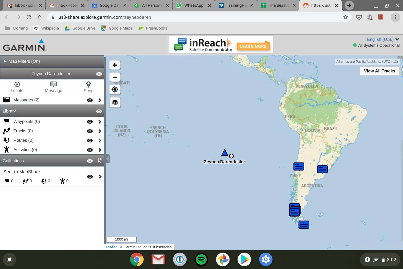
It is also one of the most remote inhabited islands in the world. (Below image is the reading from my GPS tracker.) The nearest inhabited Polynesian island is 2,075 kilometers away and the nearest continental point in Chile is 3,512 kilometers away. And yet - humans! Two canoes of people (according to oral history) came to the island around the 12th century from the Polynesian islands further northwest. These people lived on the island by themselves until the 18th century, when the Europeans spotted the island on Easter Sunday. Hence the name Easter Island.
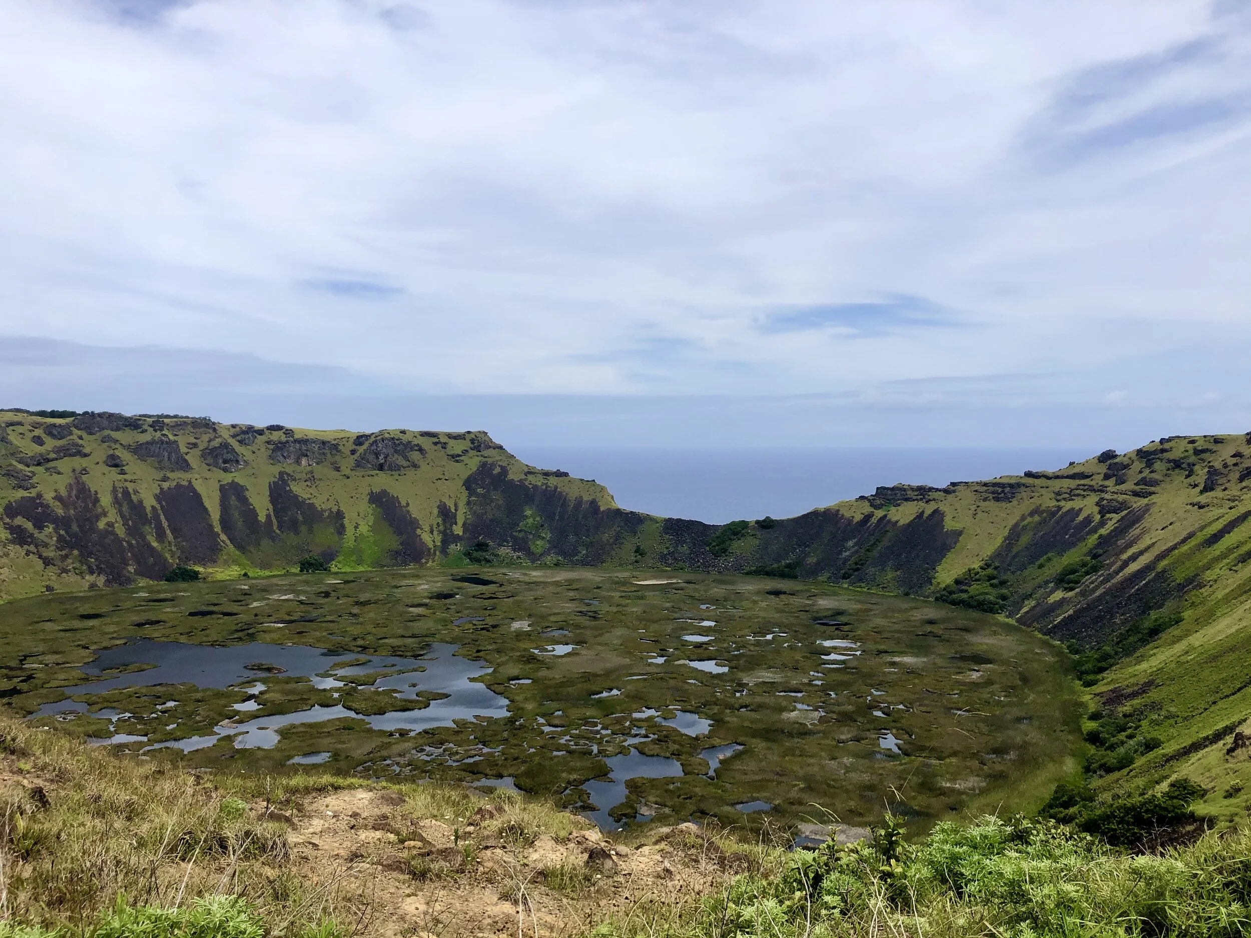
The island is so small that on my first day’s hike to Orongo, I was thinking about how various tribes kept order on the island. It seemed that if they were warring, they would easily all destroy one another. (Which was a correct assumption it turned out, see more later.) Orongo had the answer to my initial question though. Near Orongo, on the southern tip of the island, there is a huge volcano crater that has collapsed. One side of the crater wall creates a steep cliff separation between the wetlands inside the crater and the Pacific ocean. See below. (Also, in that direction, about 6,930 kilometers away is a New Zealand, with Corey on it.)

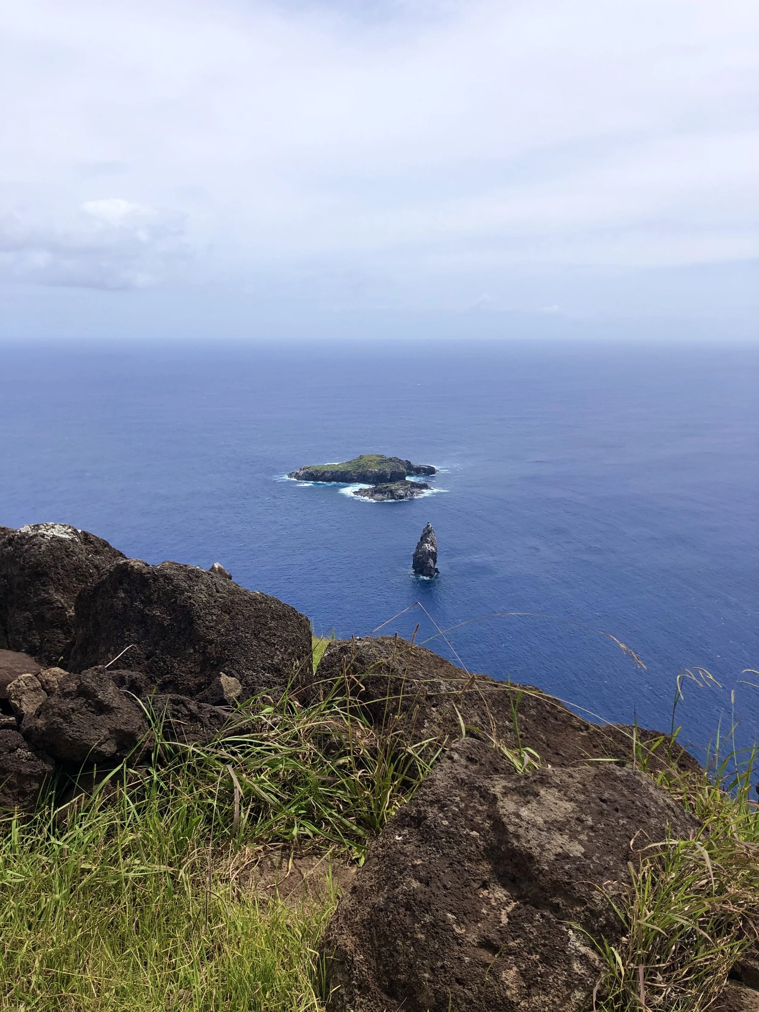
I thought it was pretty impressive and so did the Polynesians. They considered this site sacred. Just 2 kilometers off of that crater rim, southwest of the main Rapa Nui Island, is a very small island / jutting of rocks. The Polynesians noticed that once a year, the migratory manatura birds would come to this tiny island to lay eggs and rear their young. So, to choose a leader for the island among the seven tribes, they designed a triathlon of sorts - consisting of rock climbing down to the sea along the steep cliff edge of the crater, swimming to the tiny island and hunting down one of the manatura eggs. The man who came back first with an egg won, for a year. This was repeated on an annual basis. The egg is the size of a golf ball and none of the information panels answered my question on how they were able to protect the egg while swimming back 2 kilometers and climbing the steep cliff, but alas. Below is the island.

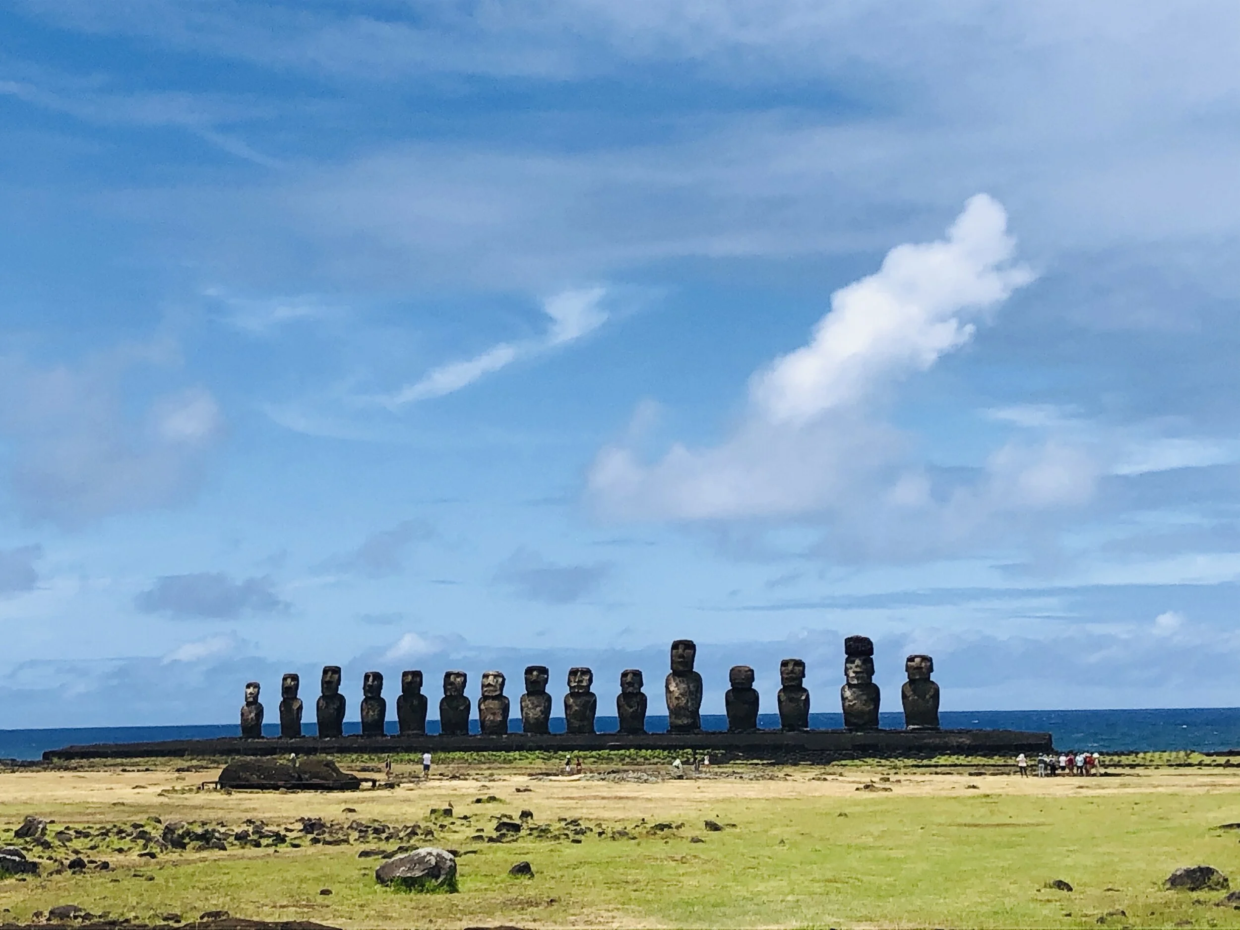
This system seems to have kept order for about half a millennium or so, and the Polynesians thrived. This and the cooperation between the tribes allowed them to build the 1,000 or so giant statues called moai on the island. These monuments were made to honor chiefs, leaders and ancestors. There was a “mass production” of these monuments out of a single volcanic rock quarry. The sculptors and workers from all tribes would work together to carve the moais out of the volcanic rock, carving them on the side of the mountain as lying down figures. (See photo below from quarry.) Once the lying down figure was nearly complete, they would chisel away the bottom, transport the moai on wooden logs to the desired part of the island, and stand it up by ropes. Over the years, the moai production grew in size, output and sophistication as the population grew. As the population on the island grew however (reportedly up to 18,000 inhabitants), as did deforestation on the island, and a shortage of food. In the early 18th century, before European arrival, the island descended into civil war, with tribes fighting against one another. The quarry was abandoned, as well the moais in transit, which is why there are half complete and in-transport moais on the island. And when one tribe won over another, in a final symbolic blow to the defeated tribe’s honor and ancestors, they would topple that tribe’s moais. There are also sad-looking, face-down moais on the island for this reason. As a result, by European arrival, the population was around 2,000 to 3,000! European diseases and slave trading expeditions brought the Rapa Nui population to an all time low of 111 people by the end of the 19th century. (Currently, there are about 3,500 people on the island who identify as Rapa Nui, out of a total island population of 7,750.) Chile annexed the island in 1888 and banned slavery. In 1995, UNESCO declared the island a World Heritage Site.


As I wrote above, the current island population is about 8,000, with an additional 100,000 tourists visiting each year. For the curious, the island is electrified by 3 diesel generators, with the diesel shipped in. Only those of Rapa Nui ancestry can own land on the island. Schools teach Rapa Nui language throughout the end of high school, after which students need to go the mainland for university.
Due to the singular emphasis on the monumental statues, what people seem to forget to tell you before you go is that the island is also gorgeous. And the horses roam free.


